Coastal Corridor Partnership
The Coastal Corridor Partnership is a weed control program that focuses efforts in the coastal areas of high conservation significance in Hobsons Bay. The program was funded with support of the Victorian Government to protect native plant and animal species from high-risk weeds across Greater Melbourne.
Parks Victoria Jawbone Flora and Fauna Reserve, Clare Reushle and Bill McNeill; Bunurong Land Council, Shani Blyth and Andrew Downs; Hobsons Bay City Council, Rosalee Kennedy, Frank Fardell and Adam Kemp.
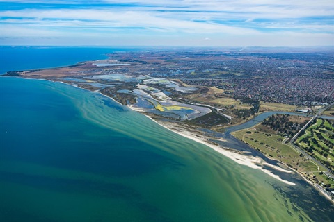
The Hobsons Bay area has been historically known for its unique maritime heritage and industrial precincts, however, beyond urbanisation and industry, lay some incredibly important areas for biodiversity including, coastal vegetation and mudflats which provide feeding, roosting and nesting areas for critically endangered migratory wading birds and local shorebirds.
Priority target weeds with long lasting habitat altering effects have been identified within this coastal space. Target weed species are spread across and between authority boundaries with primary vectors of spread including wind, animals and water (tide and currents). This Coastal Corridor Partnership grant will provide a platform for land managers in Hobsons Bay and Parks Victoria to collaborate and align works more closely, whilst engaging with Traditional Owners - the Bunurong Land Council and the general community for best practice outcomes.
After a very successful 2023-25 program we obtained a new partnership grant from the Department of Energy, Environment and Climate Action (DEECA) to extend works through to 30 June 2027.
Project Partners:
Hobsons Bay City Council
Bunurong Land Council
Parks Victoria - Point Cook Coastal Park
Parks Victoria - Jawbone Flora and Fauna Reserve
Melbourne Water
Project maps
Project area above: Blue - Jawbone Flora and Fauna Reserve, managed by Parks Victoria
Yellow - Rifle Range Reserve, Paisley Challis Wetland and Altona Coastal Park, managed by Hobsons Bay City Council
Project area above: Blue - Cheetham Wetlands, managed by Parks Victoria
Yellow - Truganina Park and the Sandy Spit, managed by Hobsons Bay City Council
Recent projects
Laverton Creek Estuary and the Sandy Spit
In recent years, Hobsons Bay's conservation team have been completing weed control works on the Laverton Creek Sandy Spit (see map below). This site is not accessible to the public and the limited disturbance means the site is a great habitat for wading birds and shorebirds to roost and feed.
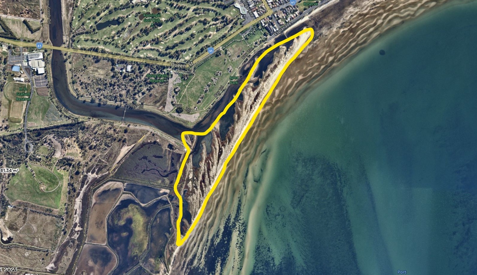
Laverton Creek Estuary and the Sandy Spit (yellow line)
This site is unique as the land area is constantly growing due to currents and land erosion in the bay. As the land area grows towards the Altona coastline, it recruits many plant species typical of saltmarsh environments on the Laverton Creek edge and coastal environments in the dune systems. These environments are critical habitat for our resident and migratory shorebirds such as Red-Necked Stints that feed in the mudflats of Laverton Creek.
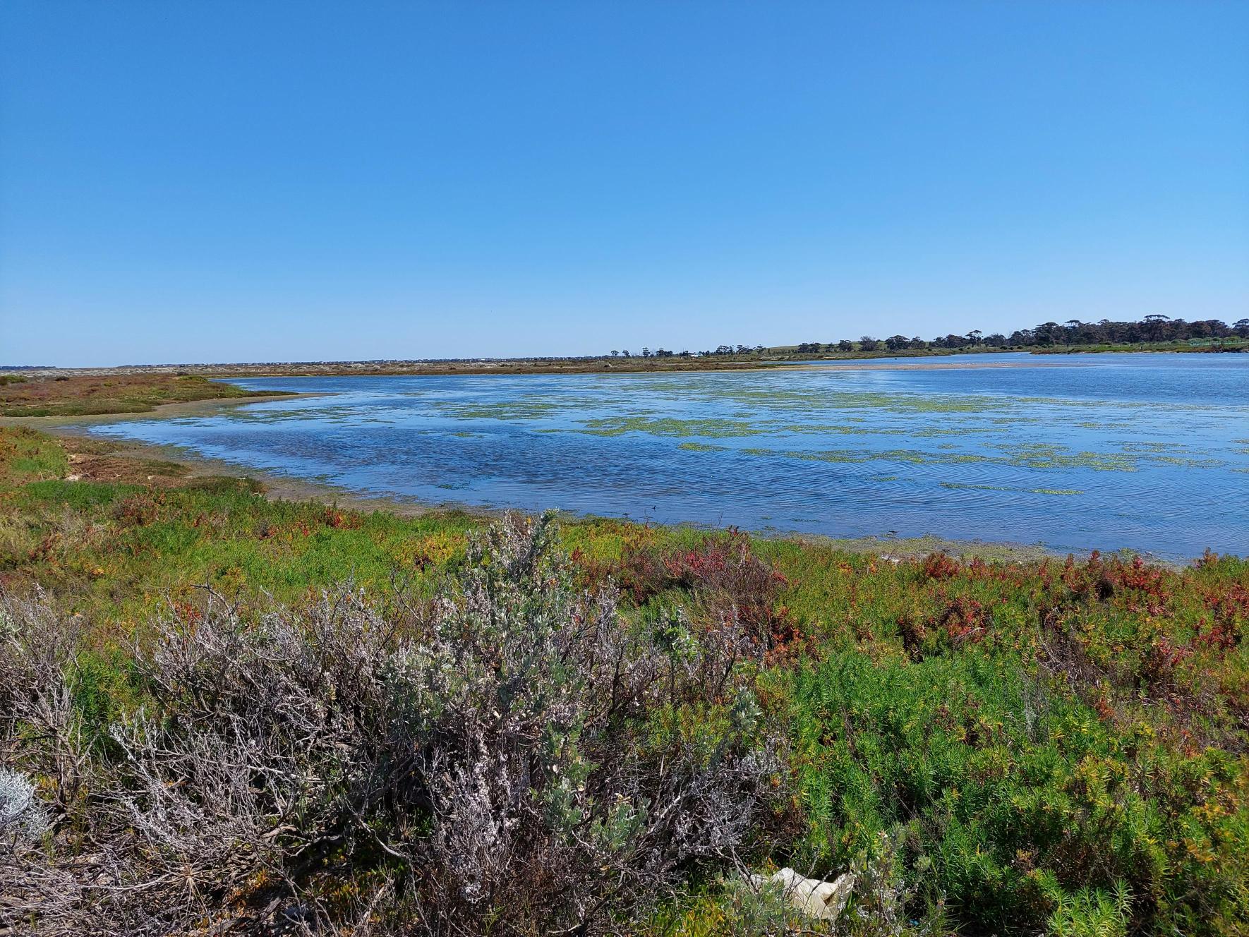
Mudflats of Laverton Creek
Conservation team crossing Laverton Creek to conduct works
The site mostly consists of locally indigenous plant species such as:
- Coastal Salt Bush (Atriplex cinerea)
- Hairy Spinifex (Spinifex sericeus)
- Cushion Bush (Leucophyta brownii)
- Coast Spear Grass (Austrostipa stipoides).
However, this site does have some exotic weed species such as:
- African Boxthorn (Lycium ferocissimum)
- Spiny Rush (Juncus acutus)
- Sea Spurge (Euphorbia paralias)
- Sea Wheat-grass (Thinopyrum junceiforme).
Weed control efforts in previous years were prioritised around habitat altering weeds such as African Boxthorn, Boneseed, Spiny Rush and Sea Spurge. The abundance of these weedy species has successfully decreased through targeted and consistent follow up weed control in this area. This has allowed our focus to shift to controlling Sea Wheat Grass, a rapidly spreading weed that is direct competition for the locally indigenous Hairy spinifex species.
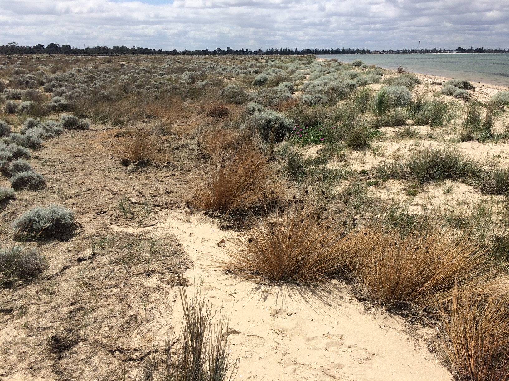
Dead Spiny Rush plant in foreground and locally indigenous Cushion Bush on Sandy Spit
This site is a great example of how consistent and follow up weed control can result in great outcomes in terms of weed eradication and providing habitat for our wildlife.
Conservation team on Sandy Spit
Gallery
Sea spurge (Euphorbia paralias) on Laverton Creek Estuary. Sea spurge is a weedy plant that if not controlled, can spread rapidly and dominates coastal foreshore environments. This can have harmful impacts on our some of our shorebirds such as Red Capped Plovers that use the open foreshore areas for nesting and foraging.
Boneseed (Chrysanthemoides monilifera),woody weed in flower at Cheetham Wetlands
Norfolk Isalnd hibiscus (Lagunaria patersonia) with seed at Jawbone Flora and Fauna Reserve.